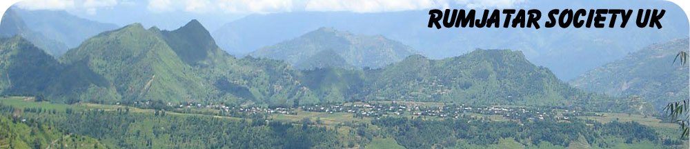
Rumjatar is a bustling village, a lone plateau with an area of 2.5 sq km in Okhaldhunga district of Sagarmatha zone in eastern part of Nepal. Its geographical coordinates are 27° 18′ 0″ North, 86° 33′ 0″ East. Rumjatar is predominantly a Gurung settlement but is also a home to large numbers of minority communities. Rumjatar has a tolerant and secular society where different communities’ blends well and compliment each other. Its vibrant economy is based on agriculture and duly supported by remittance sent from overseas. Rumjatar is renowned for its hand-made Rhadi (woollen rug) and seasonal orange crops. It has its own history and culture. The people who hail from Rumjatar are collectively known as RUMJATARELIS (TARELIS).
Latest Updates:
- 2018 Events have been updated (२०१८ साल को कार्यक्रमहरु समावेस गरिएको छ ) Click here
- Rumjatar Airport – Plane landing on new pitched runway (रुम्जाटार को एरपोर्ट मा Plane landing को एअक झलक